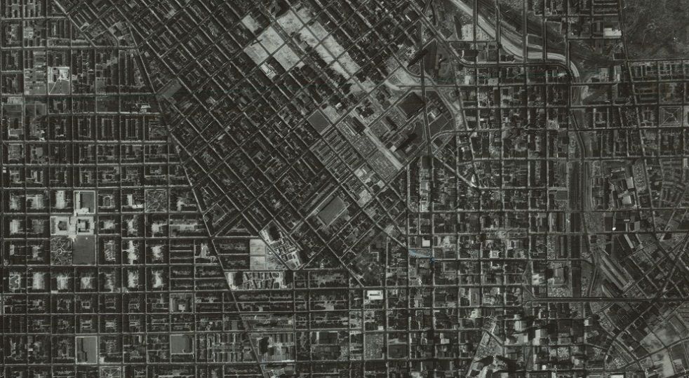
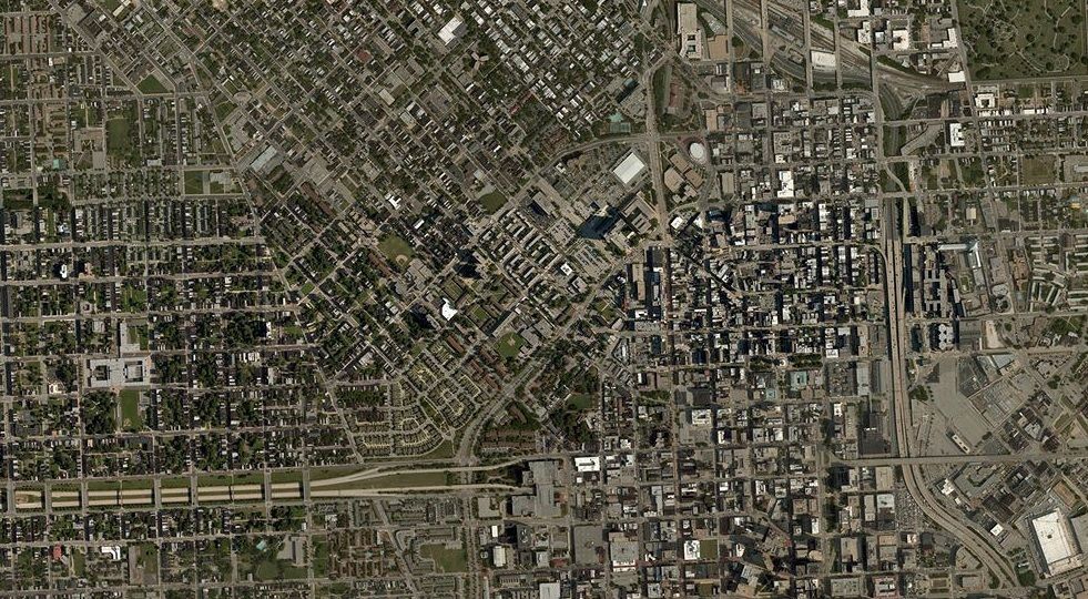
This slider shows the midtown area of Baltimore City, using 1964 aerial imagery. This imagery was taken well before the construction of the damaging Highway to Nowhere on the West Side and a few months before the final construction of the Jones Falls Expressway where it terminates downtown. One can also see both the Lexington Terrace and Murphy Homes Public Housing and those project's replacements along Martin Luther King Boulevard in the 2014 imagery.
This photo is interactive, if you are using a computer, one may slide the blue bar left or right.
No comments:
Post a Comment